Twenty-Two Miles and a Hundred Years Away: Ramsey’s Draft Wilderness
The old-growth hemlocks that made this place famous are dying.

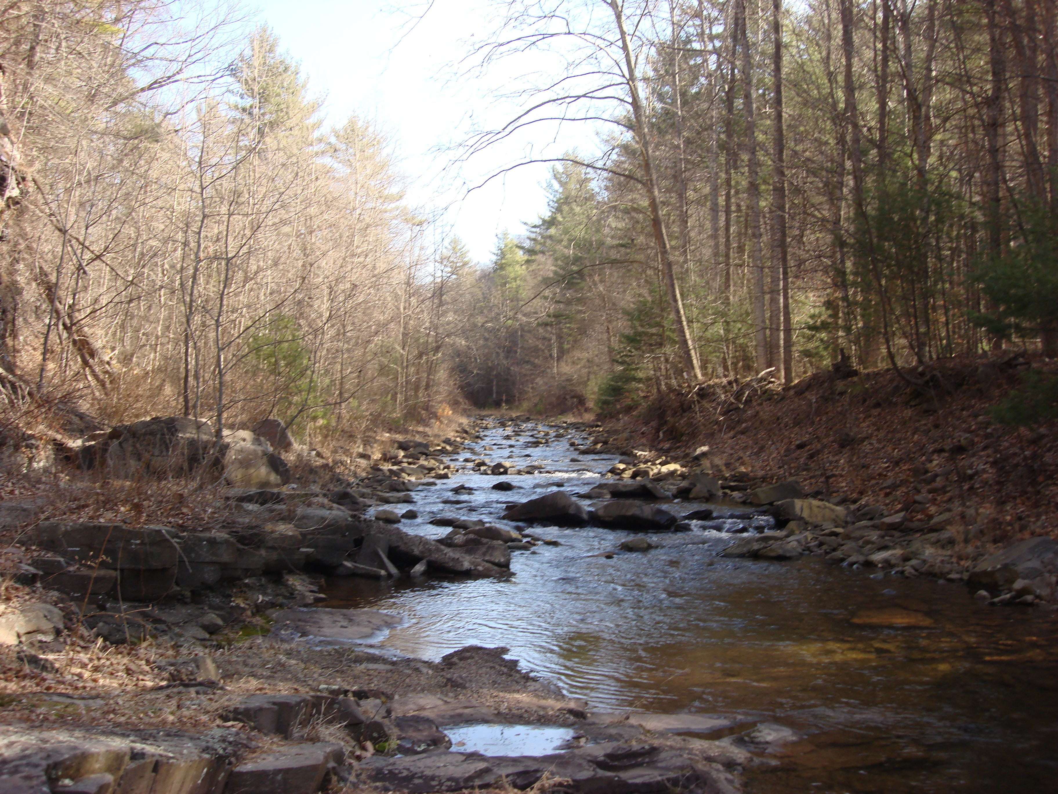
Ramsey’s Draft Wilderness has been famous for its stands of old-growth eastern hemlock for as long as people have been writing about it. The trees along the creek bed in the lower hollow are massive, their trunks thick and centuries old, among the most significant concentrations of ancient hemlocks remaining in the eastern United States. The hemlock woolly adelgid, an invasive insect that arrived in Virginia decades ago, has killed off many of these trees, opening the forest floor to sunlight for the first time in hundreds of years. What remains is still worth the drive, but it is a bittersweet place, and you should know what you are walking into.
The wilderness sits about 22 miles west of Staunton, tucked between the crests of Shenandoah Mountain and Bald Ridge, north of U.S. Route 250. It was established in 1984 under the Virginia Wilderness Act and covers 6,518 acres, administered by the U.S. Forest Service.
However, this is not a park. The trails are not maintained in any conventional sense.
The History
The federal government first purchased land in this area in 1913, and it has been managed as wilderness in practice since 1935, as much of it had never been logged. The Civilian Conservation Corps built many of the trails in the 1930s and constructed a road more than three miles upstream from U.S. 250. That road lasted until 1969, when Hurricane Camille wiped out most of it at the stream crossings. A second flood in November 1985 erased what remained and changed the course of the stream in multiple places.
The ground carries older history too.
Stonewall Jackson’s army camped near the Mountain House Picnic Area before the battle at McDowell during the Civil War. Mountain House itself was a tollbooth and rest stop for travelers on the Parkersburg-Staunton Turnpike before the war. Confederate soldiers built breastworks at the crest of Shenandoah Mountain to keep Union forces out of the valley.
The Trail
The Mountain House Day Use Area on U.S. 250 provides the primary access. From Staunton, travel west on U.S. 250. The Mountain House Day Use Area is located approximately five miles past the turnoff to Braley Pond, at the junction with Forest Development Road 68. The trailhead is 100 yards up a dirt road from the picnic area, identified by a signboard. At 0.6 miles, the trail enters the wilderness boundary.
Ramsey’s Draft Trail (Trail 1) provides the primary access into the wilderness, covering 7.3 miles one way. It follows the streambed and the old road wherever possible. The trail crosses the draft roughly 20 times. The first crossing comes at about 0.7 miles. At high water, that first crossing is impassable. Turn around if the water is up. This is not a trail where you improvise your way through a flooded crossing.
At just over two miles, the Jerry’s Run Trail intersects from the right. For day hikers who want a shorter route into the wilderness, this junction marks a reasonable turnaround. Continuing on the main trail, Hiner Springs sits less than four miles from the Jerry’s Run junction and offers good tent camping with fire rings.
The full loop, incorporating the Shenandoah Mountain Trail and the ridge, extends to 15.8 miles with 2,906 feet of elevation gain and is rated hard by AllTrails, with an estimated eight to eight and a half hours to complete. The ridge section passes over The Peak, The Pinnacle, Gordons Peak, and Big Bald Knob before descending back toward the draft. The elevation at the high point reaches 4,282 feet at Hardscrabble Knob. Budget a full day and do not start late.
Some trail sections are hard to spot and not well marked, though trail intersections are signed. Bring a map. A download from AllTrails or a USGS topo before you leave is not optional here.

What Lives There
The Virginia Department of Wildlife Resources describes Ramsey’s Draft as popular among birders because of the nesting grounds it provides for neotropical migrants at high elevations. At the upper elevations, look for Carolina and black-capped chickadee, Blackburnian and black-throated blue warblers, and scarlet tanager during breeding season. In the lower elevations, wood thrush, northern parula, and American redstart are documented nesters. Year-round residents include cedar waxwing, American goldfinch, wild turkey, ruffed grouse, and red-shouldered and red-tailed hawk.
The DWR also notes black bear, red fox, raccoon, and rattlesnake. Wikipedia lists beaver among the common wildlife documented in the wilderness. Move carefully near rocky sections and stream banks.
Ramsey’s Draft is also a native brook trout stream. Over 250 species of vascular plants have been identified in the wilderness, including tulip poplar, eastern white pine, sugar maple, black birch, shagbark hickory, and northern red oak alongside the surviving hemlocks.
Planning Your Trip
Getting there: From Staunton, travel west on U.S. 250. The Mountain House Day Use Area is located on U.S. 250 approximately five miles past the Braley Pond turnoff, at the junction with Forest Development Road 68. There is a parking area and a kiosk. Sign in at the kiosk before heading out.
Distance and difficulty: The primary Ramsey’s Draft Trail runs 7.3 miles one way. The full loop is 15.8 miles with 2,906 feet of elevation gain, rated hard. Do not attempt the full loop unless your party is fit, experienced, and carrying a full day water supply.
Wilderness regulations: Group size is limited to 10 people inside the wilderness boundary. Mechanized equipment, including bicycles, is not permitted.
Water: Ramsey’s Draft is a native brook trout stream and water is generally available in the lower hollow, but always purify before drinking. Water can be scarce on the ridge section. Plan accordingly.
Trail maintenance: Trails are maintained by volunteers with the Potomac Appalachian Trail Club and the Southern Appalachian Wilderness Stewards. Expect blowdowns, overgrown sections, and uneven footing throughout.
Contact: U.S. Forest Service, North River Ranger District at 540.432.0187.
Wilderness conditions change without notice. Verify current trail status with the North River Ranger District at 540.432.0187 before your visit. Sign in at the trailhead kiosk, carry a map, and tell someone your plans before heading out.
Have a trail report or outdoor story worth covering? Contact us at brad@stauntonian.com.