

The Highest Point in Augusta County is Standing Watch
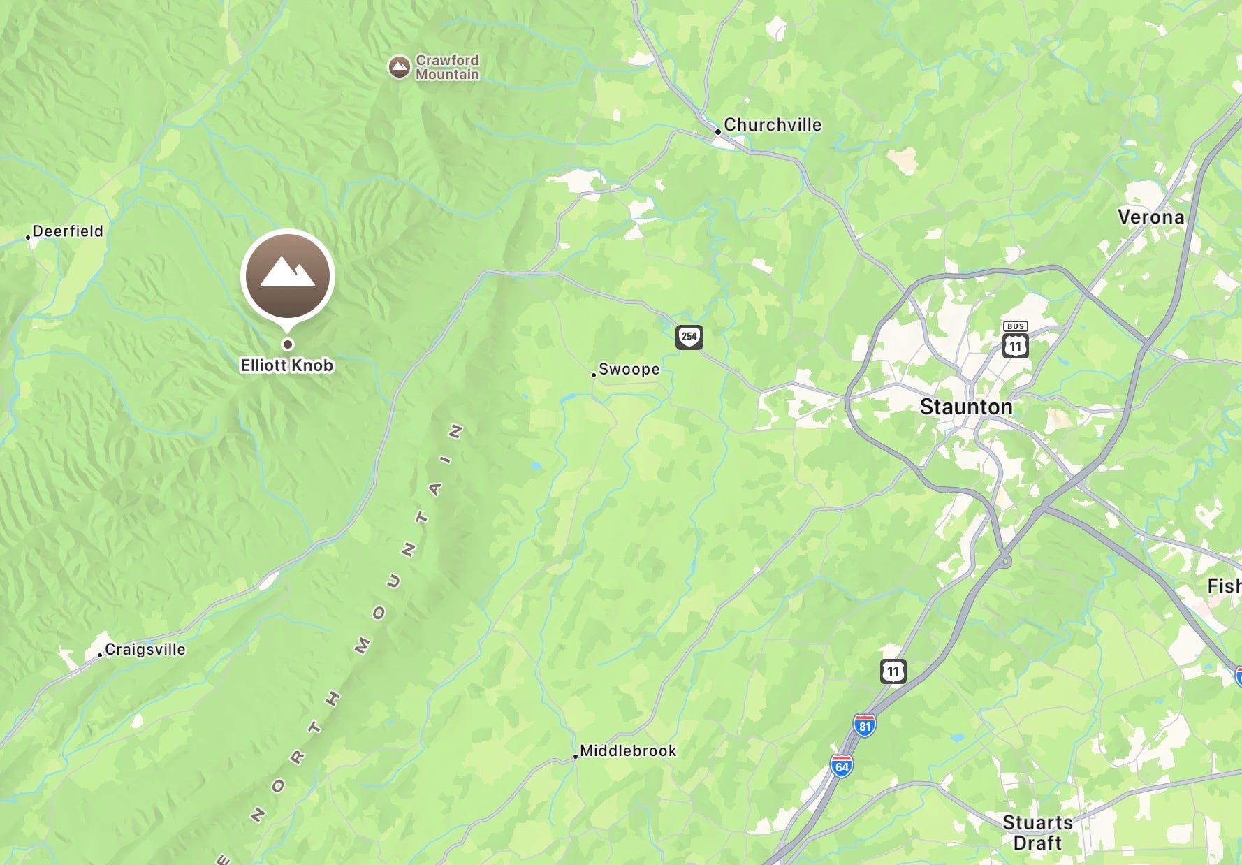
Elliott Knob holds one of only three remaining fire lookout towers in Virginia. On a clear day the summit sees from Massanutten to the Peaks of Otter. It starts 25 miles west of downtown Staunton.


There is a fire tower on top of Augusta County. Most people who live here have never seen it.
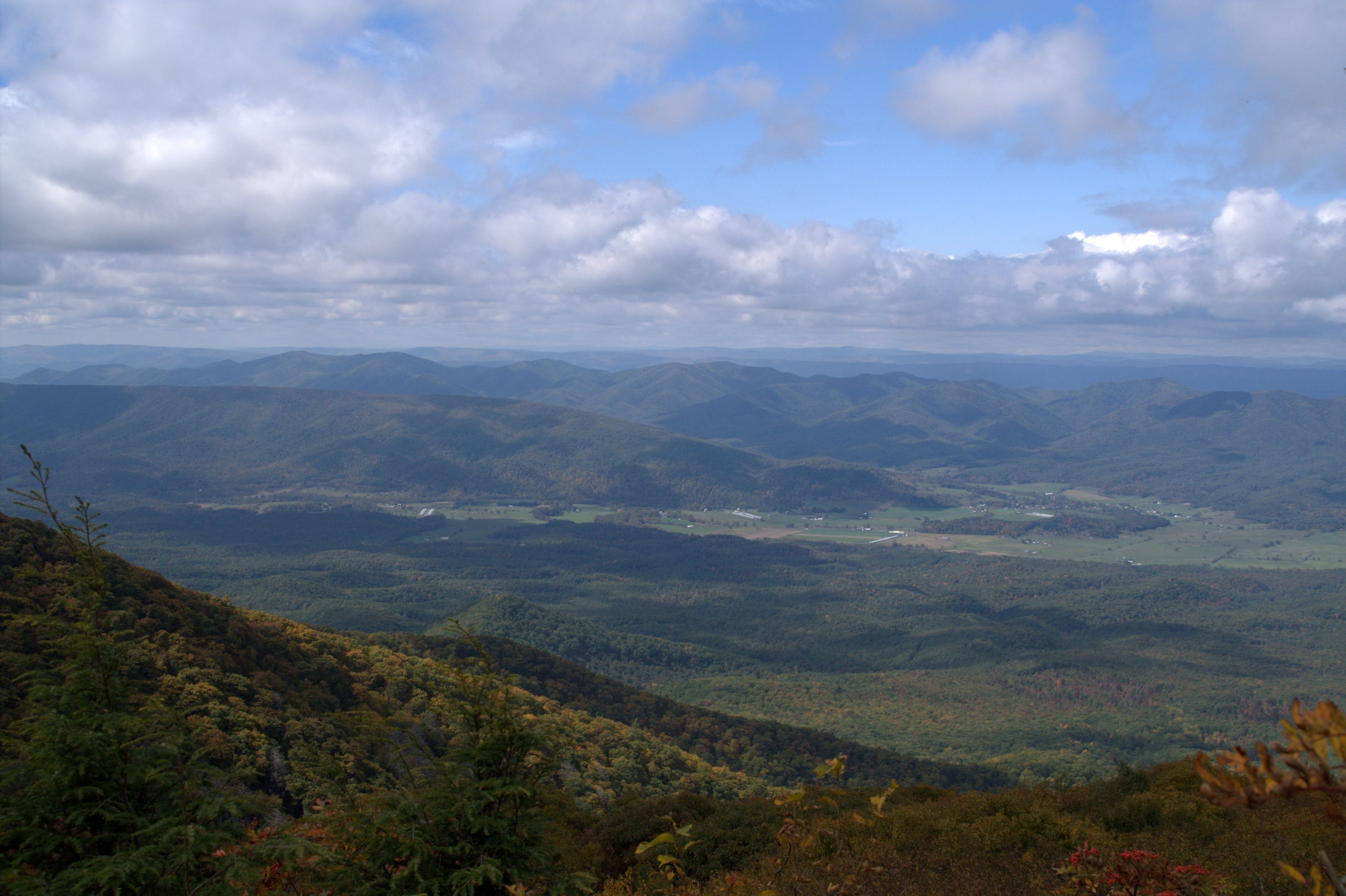
At 4,463 feet, Elliott Knob is the highest point in Augusta County and the tallest peak in the George Washington National Forest. The summit sits on the crest of Great North Mountain, and on a clear day the views stretch north toward Massanutten and south toward the Peaks of Otter. The fire tower at the top, a metal 14-by-14-foot live-in cab with catwalk atop a 30-foot steel frame built in 1948, replaced an earlier structure from the 1920s. It is one of only three lookout towers of its type remaining in Virginia. The gate has been reported open by recent visitors, though conditions change. Climb it if it is.
Getting there is another matter entirely.
Before You Go: Know Your Route
Multiple trails reach the summit, and the distances vary considerably depending on which trailhead you use. The most commonly described approach from Staunton is the Falls Hollow Trail off Route 42, south of Buffalo Gap. SummitPost lists this route as 4.25 miles one way with 2,425 feet of elevation gain. The Virginia Department of Wildlife Resources describes the North Mountain Trail from a separate trailhead off SR 688 as approximately 4.6 strenuous miles to the summit. These are different trails from different starting points. Check your map and confirm your trailhead before leaving the car.
The George Washington National Forest North River Ranger District can be reached at 540.432.0187 for current trail conditions, seasonal closures, and fire restrictions. Call before you go.
The Falls Hollow Approach
The Falls Hollow trailhead sits on Route 42, approximately two miles south of Buffalo Gap, just past the entrance to the Shenandale Gun Club. It is a gated forestry road, and the parking is extremely limited. There is no formal lot. If you arrive and the pulloff is full, additional space can sometimes be found a short distance down the road near the fire road gate. Arrive early on weekends.
From the gate, the trail follows an old logging road, wide and gently graded, marked throughout with yellow blazes and yellow plastic diamonds. The first mile and a half are easy enough that you may start to wonder what the fuss is about.
Then the trail finds Falls Hollow Run.
For roughly half a mile, the path follows the creek through a narrow hollow, passing two waterfalls. They are not towering cascades, but in spring, when snowmelt fills the run and hemlocks line the banks, the hollow earns its reputation. Staunton Stays notes that creek crossings in this section can be weather-dependent and affected by current water levels or snowmelt. Watch your footing.
A critical navigation point: watch for three yellow diamonds on a tree marking a sharp turn where the trail leaves the creek. Multiple sources warn that missing this turn sends you into overgrown, unnavigable terrain. When the going suddenly gets hard and brushy, you have missed it. Turn back and find the marker.
Past the hollow, the trail narrows, the markers shift to yellow diamonds, and the grade increases through dirt and rock. This section is manageable. What follows is not.
The Road
The Falls Hollow Trail ends at a gravel service road. Turn right. This is the road the Forest Service uses to reach the transmission towers near the summit, and it is closed to public vehicles for good reason. Recent hikers describe the grade as roughly 18 to 20 degrees for a significant stretch. There are few switchbacks. The surface is loose gravel. It is fully exposed on warm days.
This is where the hike earns its strenuous rating. Take your time. The road eventually flattens at a small pond before the final push to the tower. Watch for the North Mountain Trail intersecting from the left and shaded campsites tucked into the trees in the upper section. Backpackers planning an overnight will want to note these.
The Summit
The fire tower appears after the final climb. A grassy open area with a stone fire ring and log seating sits in front of it. Two small groves of red spruce flank the summit. At this elevation, the mountain supports tree species normally found hundreds of miles to the north, with yellow birch and sugar maple also present in the upper canopy.
The tower is surrounded by a metal fence. Recent visitors report the gate open and the tower climbable, though the structure is aged and the stairs have been described as weathered. Climb at your own judgment. The Forest Service has left access open, and that trust is worth respecting: do not damage the structure, and leave nothing behind.
The telecommunications towers and antenna equipment near the summit are active, clearly marked, and off-limits.
What Lives Up There
The Virginia Department of Wildlife Resources lists Elliott Knob on the Virginia Bird and Wildlife Trail. The elevation transition across the hike crosses multiple ecological zones. In the upper hardwood and spruce forest, look for scarlet tanager, black-throated blue warbler, and yellow-billed cuckoo during breeding season. Broad-winged hawks have been observed during fall migration. The DWR also notes northern copperhead snakes in the leaf litter of the woodlands. Watch where you step, particularly around rocky areas and stream crossings.
The area is documented black bear habitat. The Virginia Department of Natural Heritage has recorded rare plant species along the ridgeline.
Planning Your Trip
Distance and difficulty: The Falls Hollow Trail approach is listed by SummitPost as 4.25 miles one way with 2,425 feet of elevation gain, making the out-and-back roughly 8.5 miles. This is a strenuous, full-day hike. It is not appropriate for young children on a first outing or anyone not comfortable with sustained steep climbing on loose gravel.
Getting there: From downtown Staunton, take Route 254 west through Buffalo Gap, then continue south on Route 42. The Falls Hollow trailhead is approximately two miles past Buffalo Gap, on the right side of the road just past the Shenandale Gun Club entrance. It is a gated forestry road with no formal parking area. No fee is required.
What to bring: Carry water for the full day. There is no reliable water source on the upper trail without a filter, and the service road section is fully exposed on warm days. At least one account from a summer hike recommends 4 liters. Trekking poles are useful on the descent. Long pants help in summer when the hollow section can be overgrown. A map is essential: the Forest Service recommends all trail users carry a reliable map given the number of intersecting trails in the area.
Camping: Dispersed campsites with stone fire rings are available near the summit. Contact the North River Ranger District at 540.432.0187 for current fire restrictions and any seasonal closures before you go.
Best seasons: Spring and fall are the strongest choices. The hollow is at its best in April and May when water levels are high and wildflowers are out along the trail. Fall color on the ridgeline typically peaks in mid-October. Summer visits are feasible but demanding on the road section; start early and carry extra water.
Dogs: Allowed, but must remain on leash per AllTrails.
Trail and road conditions change. Verify all information with the North River Ranger District at 540.432.0187 before heading out. Hike within your ability and tell someone where you are going.